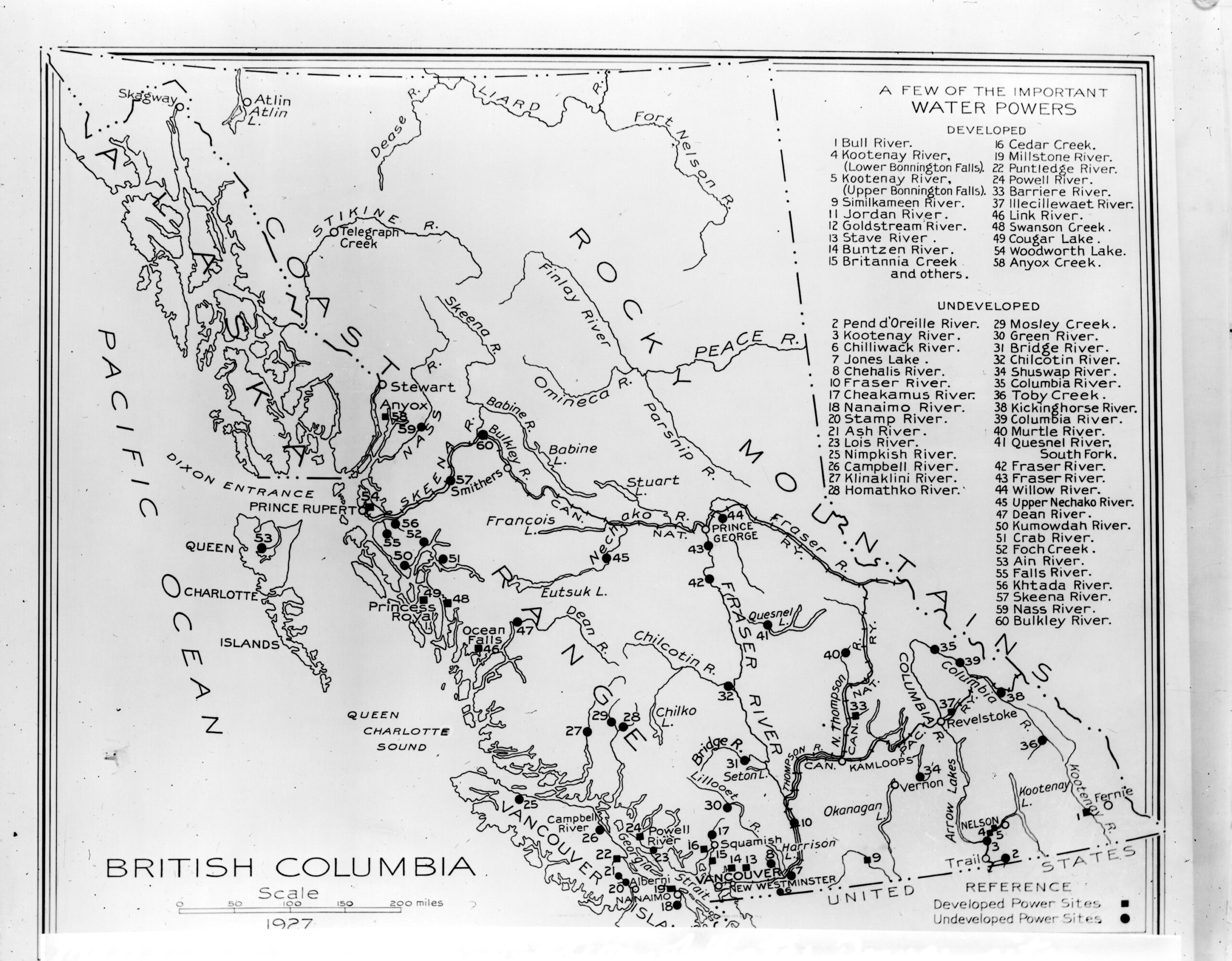
Water Power Sites
This map shows the location of developed and undeveloped water power sites near rivers and lakes in the 1920s. Learn more about this map here The Copyright Act applies to materials that are part of Royal BC Museum and Archives collections; this includes but is not limited to still images, documents, cartographic records, sound recordings…